Plume Transport Study (Wager-up, ’06)
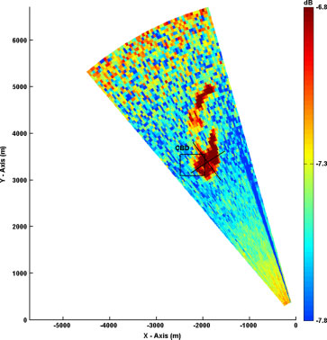
As part of a broader field campaign dubbed Wagerup 2006, a case study was carried out to determine the overnight pollution transport mechanisms and flow characteristics near Wagerup, Western Australia. The ambient conditions were characterized by stable stratification with little synoptic influence in the lower boundary layer. An elevated jet intrusion originating on a nearby escarpment slope was found to induce sufficient mixing causing elevated pollution plumes to reach ground level. Onset of mixing was accurately predicted by non-linear critical Richardson number estimates obtained in previous laboratory work. The increase in ground level temperatures brought about by shear induced mixing later prompted a sea-breeze like gravity current that was completely blocked by the escarpment and as a result pollutants were trapped against the escarpment slope. A notable side effect of the topographic blocking was the subsequent steady 360° rotation of ground level winds within an area of influence described by the Rossby deformation radius.(Retallack et al. 2010)

Figure: (a) An idealization of a 2D slope flow typically used in theoretical and numerical studies. The background potential temperature θV varies linearly, and δ represents the temperature deficit due to cooling. (b) A Doppler Lidar image of a katabatic flow velocity over an escarpment with a gridded surface showing the topography inWager-up,Western Australia. The color code represents the radial velocity magnitude of the Lidar beam (for site details, see Retallack et al. 2009). The slope flow separates at (i) into an almost quiescent fluid (ii), perhaps as an intrusion. The initial momentum of the intrusion causes downward propagation. Note the diffusion of momentum surrounding the intrusion (iii), possibly because of entrainment. The tessellations at the top of the figure result from noise. Figure courtesy of Charles Retallack (ASU).
Puff Dispersion using Coherent Doppler Lidar
Dispersion modelling is a key component of modern emergency responses to catastrophic atmospheric releases. However, periodic algorithmic advances are needed to effectively use new datasets acquired with modern remote sensing instruments. This work demonstrates that coherent Doppler lidar can be used to provide valuable new inputs for dispersion models. While related research seeks to retrieve other required inputs for dispersion modelling systems, for example velocity vectors from radial velocities, this paper assembles and contextualizes analytical and algorithmic approaches for an improved understanding of dispersion characteristics in specific atmospheric scenarios using Doppler lidar data. Longitudinal (along-wind), lateral (cross-wind), and vertical dispersion parameters are calculated and used to estimate eddy diffusivities based on Gaussian curve fitting and first-order closure. Empirical relations based on similarity theory are used to verify these estimates, and reasonable agreement is found between the two approaches. Several improvements are also suggested for the lidar scanning techniques to facilitate retrieval of dispersion parameters. (Choukulkar et al. 2011)

Remote Sensing for Wind Energy


